


Experience the ultimate trekking experience in Bhutan by completing the Trans Bhutan Trail end-to-end trek, one of the world's greatest treks. Walking 403 kilometers from Haa in the west to Trashigang in the east, passing through several temperature zones and experiencing a range of culturally absorbing activities, with many historical and religious monuments along the way. Rest days are scheduled for Punakha and Bumthang.
A Bhutan tour includes many elements that enhance your trip to Nepal. Initially, you will experience the Land of Thunder Dragon Bhutan, followed by a close-up view of the Himalayas. All of these places are beautiful and offer breathtaking views. Views of the Himalayas provide scenic views of some of the highest glacial peaks in the world. The Paro Valley is also a wonderful site to see. The natural beauty of this area will leave you speechless.
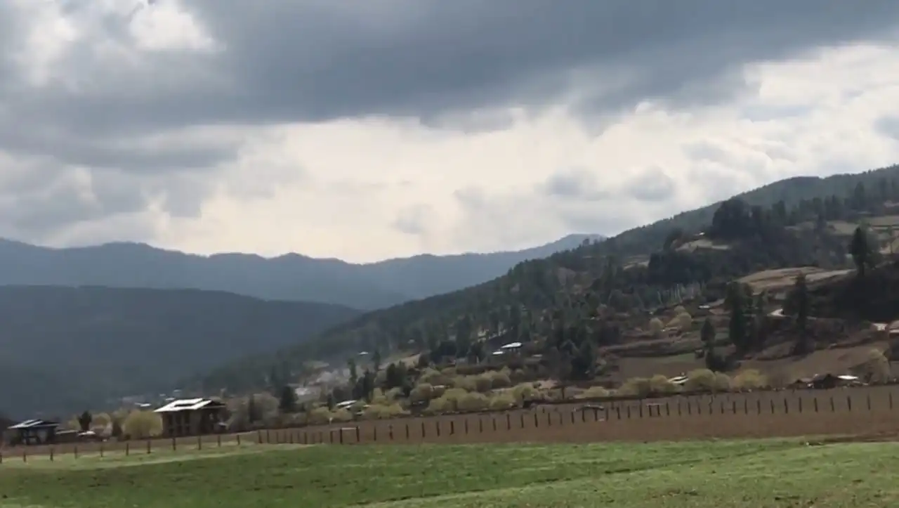
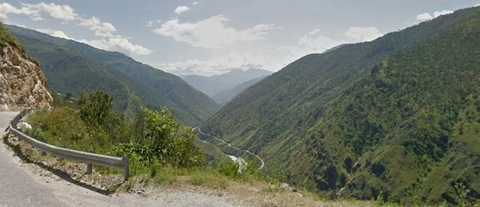
The End-to-End Bhutan Trek will give you the opportunity to discover a lot of new things and discover more of Bhutan. The Himalayan Circuit offers this marvelous trip that takes you to the heavenliness of Bhutan. You can now admire ancient temples, monasteries, and Dzong fortresses in the tiny Himalayan Kingdom, although the country's isolation has kept most of its original heritage and culture intact. Nestled in the Himalayas, this country offers breathtaking mountain views, lush green forests and copper mines, as well as agricultural terraces where fruits, rice, tea and tobacco are grown. The stunning national parks are surrounded by cities steeped in culture and populated by friendly locals. Bhutanese, the majority of whom are Buddhists, consistently rank as the happiest people in Asia in international polls.


Highlights of the day:


Upon your arrival at Paro International Airport, you will be greeted by your guide. A short stop at Chelela, Bhutan's highest paved road at 3,810 meters (12,500 feet) above sea level, will allow you to take in the stunning Himalayan panoramas on the way to Haa. Your guide and driver may want to join in the chorus of 'lha-gehlu!' Chelela is where you will encounter faith.
You will experience Bhutanese cuisine for the first time during your evening in Haa.
Highlights of the day:
This morning, after breakfast, take an acclimatization trip around town with your guide.
On your orientation walk (fortress), you will stop at Lhakhang Karpo, also known as 'White Chapel,' just south of Haa's dzong.
In the central chapel of the Lhakhang, sculptures represent the Tse-la-nam Sum triad.
As part of your visit to the Lhakhang Karpo, you will have the opportunity to receive a traditional blessing prior to embarking on your Trans Bhutan Trail adventure.
There is time for you to relax or go on another gentle acclimatization walk in the afternoon.
Highlights of the day:
Your first day of hiking on the old Trans Bhutan Trail will begin after breakfast at your hotel, after which you will be taken to Katsho. This road has been used by the residents of Haa to trade with the Parops who live in the next valley for generations. At the market in Paro Tshongdu, they would exchange Shakam (dried beef) for 20 drey of rice because the harsher climatic conditions in Haa make rice farming unfeasible.
Taking the ancient route, you will follow the beautiful Haa river as it rises out of the Katsho Valley, passing through yak meadows before entering pine and rhododendron forests. As you pass through the Katsho Valley, you can see the cliff-edge Bjungneydra Taktsang (monastery), also known as "The Mini Taktsang," and Kungkarpo's sky burial place. There is a climb to Kaleyla Pass, where the route crosses the ridge trail connecting Chelela and Sagala. Mount Jomolhari (7,314m/23,996ft) and Mount Jichudrakegang (6,794m/22,290ft) are visible from Kaleyla on clear days along with Mount Tsherimgang (6,789m/22,273ft). You will be provided with a picnic lunch during this visit.
As the route descends from Kaleyla towards the Paro Valley, it passes through a forest of rhododendrons and bamboo. Thereafter, trails wind through typical Bhutanese farming communities as you travel the final few kilometers to Paro.
You will have the opportunity to visit the Kichu Lhakhang (temple) at the Ngopa gewog (paro's Ngopa village). SongtsenGampo built the site in the 7th century, making it one of Bhutan's oldest sacred sites. There is an original statue of Jowo Jamba in Kichu Lhakhang, one of the most revered statues in the region, and two orange trees are said to bear fruit throughout the year in the monastery courtyard.
Your guide will arrange dinner for you, either at your hotel or a nearby restaurant.
Accommodation: At The Village Lodge or other three star Hotel (3*)
Highlights of the day:
This morning, after breakfast, rejoin the Trans Bhutan Trail and travel east. The route climbs gradually from Lamgong Settlement into the Paro Valley's extensive rice farms before slicing around the northern peak and down into Dopshari, a traditional village.
Enjoy a cooking demonstration and traditional Bhutanese lunch at a rural home in Dopshari. After lunch, you'll get the chance to try your hand at archery, Bhutan's national sport, and play a game of traditional 'khuru' (darts).
After lunch, return to the route for one more ascent to Upper Dopshari, where you'll be rewarded with beautiful views of the Paro Valley.
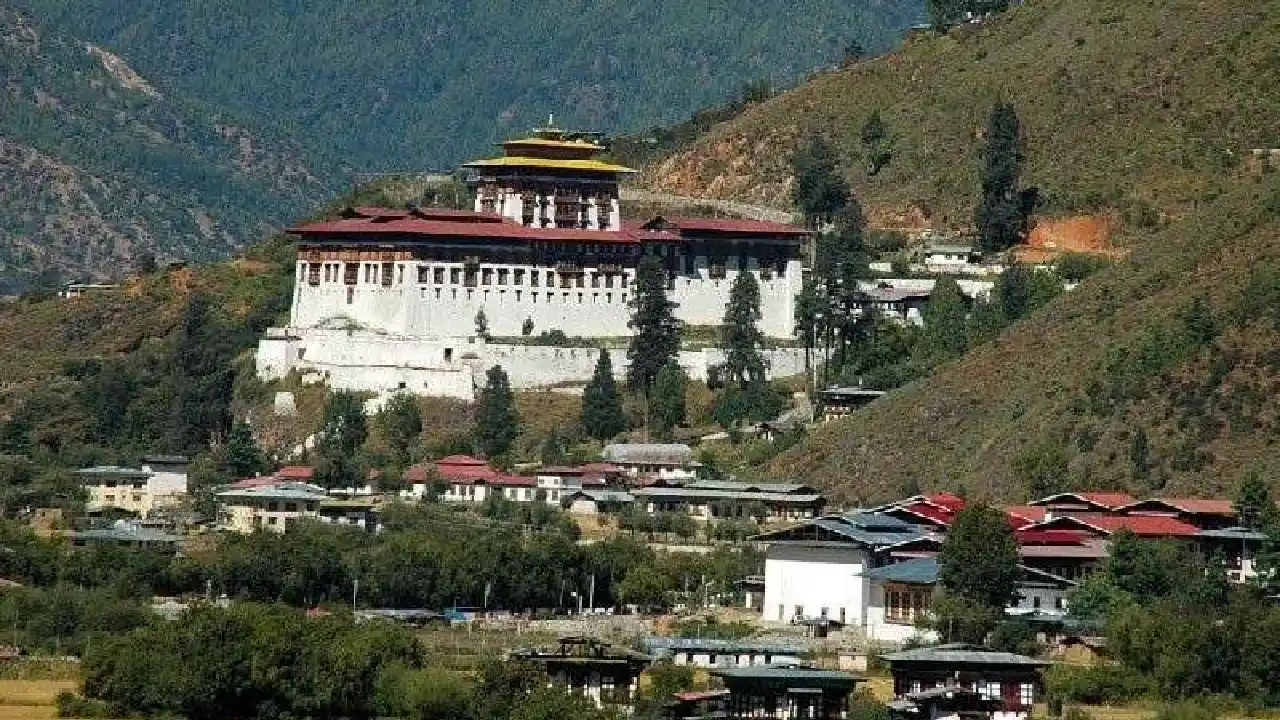
You will be picked up from Upper Dopshari and driven back to Paro. Visit Ta Dzong, or the 'watchtower,' on the way, which was erected in 1649 to guard Paro Dzong from Tibetan soldiers. Ta Dzong became Bhutan's National Museum in 1968, and it currently houses a multitude of displays portraying Bhutan's mystical history, including sculpture, painting, and relics. After that, see the majestic Paro Rinpung Dzong (fortress), which translates to "Fortress atop a Heap of Jewels." This Dzong is said to have been built in 1458, and it was restored to its current splendour in 1951 by His Majesty the Third of Bhutan, King Jigme DorjiWangchuck, to commemorate his royal wedding.
Following your tours, return to your hotel, where we recommend relaxing and relaxing in a traditional Bhutanese hot stone bath before dining with your guide at a local restaurant.

Highlights of the day:
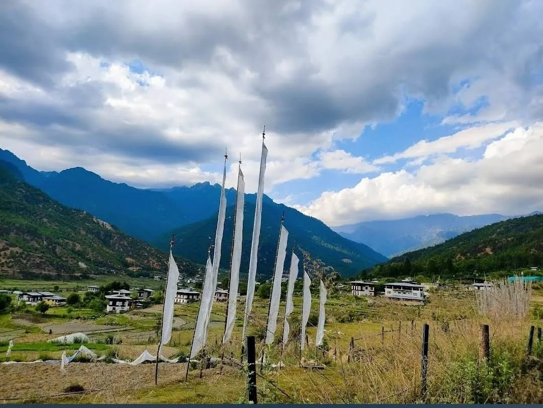
Rejoin the Trans Bhutan Trail going east towards Tsalunang after breakfast today. The hike starts today with a climb from Upper Dopshari, passing through community forestry initiatives, tiny agricultural settlements, deep forest, and along beautiful rivers. On your trip, you can come with the ideal location for hanging some lungdhar (prayer flags).
You might choose to take a short trip to Jela Dzong after a picnic lunch in Jelila (fortress). Its primary relics are the sculptures of Du Sum Sangye, which are supposed to have been seen by the guardian god Pal YesheyGoenpo on ZhabdrungNgawangNamgyel's trip to Paro (Buddha of the Past, Present and the Future).The Buddha is said to have formerly faced north, but then magically rotated to face southwest, towards Paro.
The Trail descends gradually from Jelila into the Tsalunang Valley, passing through blue pine and rhododendron trees along the way. On this stretch, bird watchers will want to keep an eye out for some of Bhutan's gorgeous species.
On arriving at your campground, enjoy a hot shower and a peaceful hot stone bath. At camp, a dinner will be made using organic, locally sourced ingredients.

Highlights of the day:


After breakfast at camp, continue your journey east towards Thimphu, Bhutan's capital city. With heights ranging from 2,248 meters (7,375 feet) to 2,648 meters (8,688 feet), Thimphu is the sixth tallest capital city in the world. The city is also the only one without traffic lights in the world. The city offers a unique combination of modernity and Bhutanese heritage.
The Trail begins at Tsalunang and then ascends through fir, blue pine, dwarf rhododendron, and yak meadows before reaching Pumola Pass. To escape the summer heat of the Punakha valley, Punakha herders used to move their livestock here.
Continue on the Trail as it meanders through picturesque meadows, with dramatic views of the Thimphu Valley from a long ridge after a picnic lunch and great mountain views at Pumola. You will be able to see your path for the next several days beyond Thimphu in the distance from here.
The Buddha Dordenma, Thimphu's most famous monument, is located at Buddha Point near the end of the day. The 51-meter tall gilded bronze statue, which has 125,000 miniature figurines, stands atop a three-story base as a guardian of the Thimphu Valley, guarding a church and thousands of donor statuettes. The statue was commissioned to commemorate Jigme Singye Wangchuck's 60th birthday, and was made in China before being shipped to Thimphu in parts.
After checking into your hotel, meet your guide for dinner at one of the many great restaurants in the capital.

Highlights of the day:


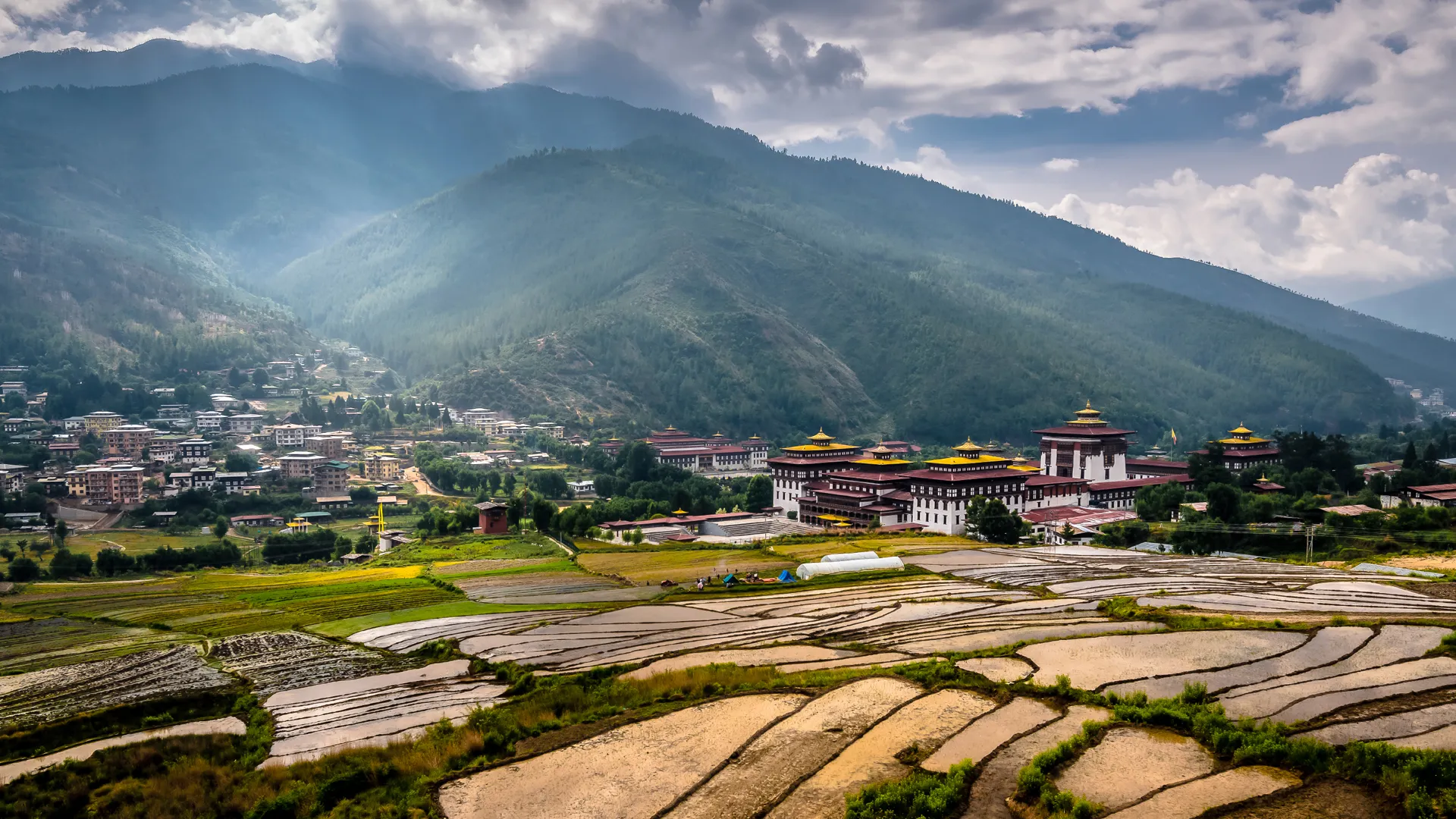
After breakfast at your accommodation, return to Buddha Dordenma to rejoin the Trans Bhutan Trail. As you descend the Debsi Valley from here, you will follow the old east-west road that connected Thimphu with Punakha, and, beyond it, the east, until the National Highway was built. After crossing the river on the motor road bridge (fortress), you will reach Simtokha Dzong via the ancient east-west road via Babesa. It is said that the stronghold was built in 1629 by ZhabdrungNgawang Namgyal on a rocky outcropping where a demon vanished previously. The Simtokha Dzong is considered Bhutan's first dzong (fortress) built to accommodate both governmental and monastic occupants, as well as the oldest to have been intact for so long. In addition to a three-story utse and several chapels, the Dzong has several beautiful paintings, sculptures, and tapestries.
In Simtokha, you will pass through orchards, strawberry farms, and market gardens as you climb slowly. You will stop for a picnic lunch at a lovely location along the way while passing through lush forest and over meadows to Hongtsho. The trail will eventually reach the Dochula Pass at 3,100 meters (10,200 ft) above sea level. Mountain passes are sacred in Bhutan, and incense is often burned as an offering there. In honor of the local Gods, you could also hang colorful prayer flags.
During the Bhutanese Monarchy's 100th anniversary, the Druk Wangyal Lhakhang was built in honor of His Majesty the Fourth King Gyalpo Jigme Singye Wangchuck. This temple's paintings are one-of-a-kind in that they combine modern flourishes with century-old methods. In recognition of His Majesty the King's wise leadership and the Royal Bhutanese Army's continued efforts to preserve Bhutan's sovereignty, the Temple organizes an annual tshechu (festival). It is well worth stopping by the Druk Wangyal Chorten (stupa), which is commonly called '108 Chortens,' and its associated meditation caves.
The evening dinner today will be at your hotel.
Accommodation: Dochula Resort or other three star Hotel (3*)
Meals: B,L,D

Highlights of the day:

Among Bhutan's most spectacular sunrises can be found on Dochula Pass. As the sun rises, the Himalayan range is visible in the distance when the weather is clear.
You can join the Divine Madman Trail in the nearby valley after breakfast. As a descendant of the Drukpa Kuenley lineage, Drukpa Kuenley arrived from Tibet for the purpose of repressing demonic spirits in Bhutan in the 16th century. Over the next few days, a variety of fascinating anecdotes and cultural sites will shed light on Drukpa Kuenley's life.
Then you'll go down to Toeb Chandana after having lunch at Thinleygang Lhakhang (temple). If you arrive in Toeb Chandana Lhakhang, referred to as Chandana Lhakhang (meaning "where the arrow fell"), you must get up close to see it. Toeb Chandana is said to have been struck by an arrow during the time of Drukpa Kuenley. It was built in the 15th century to ward off demons and served as the residence of Ngawang Chogyal, the spiritual leader of Tibet. Ngawang Chogyal was believed to have owned two knee-shapknees, which were believed to belong to Ngawang Chogyal.
Toeb Tshewang's dwelling is believed to have been struck by Drukpa Kuenley's arrow when he landed next to the Temple. In a jealous rage, Tsewang pulled a sword that Drukpa Kuenley tied mysteriously, after wearing a beggar's outfit while courting Tshewang's wife. Tshewang gave Kuenley's wife as a gift to help him fulfill his predictions due to Kuenley's heavenly power. Including the wooden ladder Kuenley's arrow is said to have struck, Tshewang's family has preserved the home for fifteen generations as a memorial.
A hot shower and a hot stone bath will be waiting for you at your campground afterward. Dinner will be prepared using organic, locally sourced ingredients at camp.
Accommodation: At Signature Trans Bhutan Trail Camping
Meals: B,L,D

Highlights of the day:

Bid farewell to Toeb Chandana after breakfast when you depart this morning for Sew Drangsa. Monastic bodies have used this route for winter travel to Punakha and summer travel between Punakha and Thimphu in recent years. You will find a clearing marked with prayer flags at Sew Drangsa, which is where the monks stopped to eat on their way, just as you will today. During the descent, spectacular sights of the Punakha Valley can be seen along the way, including Punakha Dzong (fortress).
Punakha is a beautiful town, and there will be some time to go sightseeing in the afternoon. You need official Bhutanese clothing, including the gho for men and the kora for women, to cross the river on foot. You need to start at the Bazam (bridge) across the river from Punakha Dzong (fortress). On the opposite side, you will see the Dzong (fortress) built by ZhabdrungNgawang Namgyal in approximately 1637, where the Phochhu, a male river, meets the Mochhu, a female river. (the female river). In my opinion, it is the most beautiful Dzong in the country. In the utse, there is a picture of Chenresig, known as Rangjung Kharsapani, guarded by the dzong (tower).
A glacier lake crumbled as a result of Tibetan invasions, fires, flooding, and the destruction of several fires. Dzong served as the capital and seat of the Bhutanese government until the early 1950s; Gyalpo Ugyen Wangchuck, the First Druk, was crowned here. The monastic body currently resides in this building during the winter.
Following check-in at your hotel, your guide will take you to a local restaurant for dinner.
Accommodation: Zhingkham Resort or other three star Hotel (3*)
Meals: B,L,D

Highlights of the day:
Punakha is a unique mixture of cultural and spiritual traditions very much influenced by Buddhist principles and the Bhutanese lifestyle.
A divine monument that touches the spirits of those seeking refuge, Punakha is a magical place nestled in the mountains.
A scenic Shangri-La hidden behind silent hillsides, Punakha offers a world lost in time and steep, alpine valleys that are knee-deep in wildflowers.
We are spending today in Punakha, a beautiful town in eastern Tibet.
Accommodation: Zhingkham Resort or other three star Hotel (3*)
Meals: B,L,D

Highlights of the day:
Following breakfast at your hotel, rejoin the Trail heading east towards Lingmukha. We will wind through rice fields and climb steeply to the highest point of the day, a Chorten (stupa). Picnics can be enjoyed here while admiring the magnificent views of the valleys to the north.
Leaving the Lingmukha valley after lunch, the path descends to the feeder road for the final hour or so of today's climb. You'll go to the Lingmukha Lhakhang (temple) that was founded by Terton Dorjee Lingpa, the famous treasure hunter, because of the vast rice fields that lie beneath the mountains on either side. The valley is known as Lingmup Sher GZhom, which means "golden bowl." Oral tradition indicates that Dorjee Lingpa resided in Lingmukha with his disciples for some time following the construction of the Lhakhang. According to legend, the village's Great Master found many treasures.
When you're done with your temple tour, come back to your campsite to take a hot shower and a peaceful hot stone bath. An organic, locally sourced dinner will be served at camp.
Accommodation: At Signature TBT Camping

Highlights of the day:
In the morning, reenter the trail and continue east towards Samtengang. The trail would have been used frequently in the past by residents of Lingmukha and Phangyul in the neighboring valley. Both communities are blood relatives since they share similar cultural roots despite being separated by a rocky slope.
A steep climb through dense forest starts the trail deep in the Lingmukha Valley, which reaches a pass with a rest stop. Following the pass, you'll descend rapidly, taking in panoramic views of the Shar Valleys. On the way to the temple, visit the ChungseAzheGyalzom Lhakhang (temple), built on the site where Lam Drukpa Kuenley, the Divine Madman, is said to have thrown a Chan-do (a disc-shaped stone) from Sha Kuenzangling on the opposite side of the valley. Chungseykha, a nearby village, will provide us with a cooked lunch.
After lunch, you will ascend to Samtengang, where you will find your overnight campsite set up among little agricultural communities located on high slopes.
Camping at the campground is a relaxing experience, as you can take a hot shower and soak in a hot stone bath. Organic, locally sourced ingredients will be used for the dinner.

Highlights of the day:
Following breakfast at camp, you may want to stop by the nearby Lhakhang Thangkha Temple. KunkhyenLongchenRabjam supposedly built this temple as one of his eight lings (meditation and teaching venues).
Afterward, travel along a section of the Trail that was first utilized by legendarily important messengers GarpLunghiKhorlo and Chamberlin PemiTshewang Tashi. In addition to its remoteness, this region passes by no human settlements, allowing you to spend the whole day immersed in nature. The initial stretch of the path from Samtengang has an elevation, before flattening out until the road descends to Razawo at the end of the day. The Chorten (stupa) in Razawo, which is an ancient stupa believed to have been built during the reign of Buddha Kashyapa, is also one of Bhutan's most historic sites.
Return to your campsite after visiting the Chorten for a hot shower and relaxing hot stone bath. There will be an organic, locally sourced dinner served at your campsite.

Highlights of the day:

Following breakfast at the camp, depart on the Trail, which follows the river for a short distance after leaving Razawo. We climb steadily towards the Pelela Pass for the remainder of the day. Trail users will traverse an open meadow before passing by oak and walnut trees on a farm road. Enjoy a picnic lunch along the way.
The Rida Goenpa (temple) will be accessible if time permits. The most important relic of the temple is the bronze Buddha of Longevity or SangayTsepadme. A Buddhist practitioner blessed an infertile local couple with a child in exchange for their compassion by building this monument, as told in legend.
The trip to Pelela Pass from the temple is only a short one, passing through beautiful rhododendron woodlands. It is one of Bhutan's highest passes at 3,402 meters (11,162 feet) above sea level, and it is historically considered to separate the west from the center of the country. Here, there are many yak-hair craftsmen selling excellent items along the roadside.
There is a hot tub and a shower available at your campsite near Pelela. Locally sourced organic ingredients will be used in your dinner.

Highlights of the day:
Breakfast at your camp should be followed by a return to the Trans Bhutan Trail. If you descend into the meadows below Pelela, keep an eye out for the yak herder settlements scattered across the valley. Take a break in a typical Rukubji farmhouse for a tasty meal before visiting the village Lhakhang (temple), also known as KuenzangCholing. Temples like this one are usually built in a valley with a view of a ridge or on a high ridge, but this one is built on a plateau between two rivers. This temple is built on a plateau with a view of two rivers instead of over a ridge overlooking a valley. In the same spot, the Lama is said to have defeated a snake demoness, upon which he built his temple. During your stay in Rukubji, you will have the opportunity to learn its native language over tea with the locals. Currently, the dialect Ngyen-Kye is only spoken in a small number of homes in Bhutan. It is a combination of several Bhutanese dialects and some English phrases.
In the afternoon, you will rejoin the trail for a gentle climb out of the valley and through a forest before returning to Chendebji village, where you will camp. Its location is said to be where the three ridges and three edges of the sky meet, so be sure to stop by the Chorten (stupa) in Chendebji. In order to establish peace in the Chendebji Valley, Lam Ngedup Tshering Wangchuk constructed the Chorten in order to slay Nyala Dudm, a local monster.
The campsite offers hot showers, hot stone baths and organic dinners sourced locally.

Highlights of the day:
After breakfast at your tent (stupa), rejoin the trail at the Chendebji Chorten. After traveling along the historic East-West National Highway, you will reach Tangsiji and the countryside. The Tangsiji farmhouse will serve a delicious lunch.
The trail today is home to several hydropower projects. It is in part thanks to these clean, renewable energy installations that Bhutan has become the only carbon-negative country in the world. India also purchases a large amount of Bhutanese renewable energy. The Trashichoeling Lhakhang (temple) is also located in Trashiling village. This temple was built for His Majesty the Fourth King of Bhutan by His Holiness the 70th Je Khenpo in 2002.
Visit the Tshangkha Lhakhang (temple) before you travel to your campsite in Tshangkha. On an unknown date, the site where the temple stands was blessed by Lord OpenGolay of Tshangkha, a monk who acquired his knowledge and might from Tibet's Mindroling monastery. Choeng, the Trongsa Chamberlain, built the first building on this site in 1701, and this is a popular location for social occasions and religious events.
On the campsite, you can enjoy a hot shower, a hot stone bath, and an organic dinner sourced locally.

Highlights of the day:
After breakfast at your tent, return to the Trail and ascend via UgyenCholing and TsangkhaSheydra for a short, steep ascent out of Tshangkha. A short descent follows, culminating in crossing the National Highway at Trongsa viewpoint.
In addition to being the geographical center of Bhutan, Trongsa also has a strong connection to Bhutan's Royal Family: two of Bhutan's first three monarchs were born in Trongsa Dzong (fortress), and the crown prince now serves as Penlop (Governor) before ascending to the throne. Trongsa Dzong was once directly on the Trans Bhutan Trail, which still runs through Trongsa. You will replicate the experience of arriving at the mighty city on foot in the same way garps (messengers) would have done so centuries ago as you descend down the steep valley below the viewpoint and enjoy amazing views of the Dzong (fortress) on the opposite side. After crossing over the Mangde River, you'll be on the other side of the valley and through the Western gate of Trongsa Dzong (fortress).
Spend the afternoon at Trongsa Dzong (fortress), which was built by Ngagi Wangchuck in 1541 after discovering the self-confirmed footprints of PeldenLhamo on the same site. Trongsa sprang up around the construction site, meaning "new village" in the local dialect. Located in Bhutan, the current Dzong is a 17th-century fortress built-in 1644. Around 450 district monks live in Trongsa during the winter and in Bumthang during the summer. You will see an assortment of the Trongsa Ta Dzong's 23 Lhakhang (temples) before heading to the fascinating Royal Heritage Museum.
After relaxing for a while, your guide will take you to a local restaurant for dinner early that evening.

Highlights of the day:
Your morning will begin with breakfast at your hotel, followed by a gentle ascent up to Kewathang. We will cross several natural zones on today's hike, which will be beneficial to birdwatchers. From Kewathang, Yotongla Pass can be reached by traversing deep forests. Have a picnic lunch on the way.
In addition to meadows and open woodlands, the trail descends to the Geytsa River from Yotongla. The final leg of today's walk is along the riverbank towards Geytsa.
When you arrive at your Geytsa campsite, enjoy a hot shower, a hot stone bath, and an organic meal sourced locally.

Highlights of the day:
Following breakfast, we walked down a historic part of the Trail that HM the Second King would have used to transit between Trongsa and Bumthang or Bumthang and Kuenga Rabten, where his summer palace was. The Owl Trek route briefly parallels the Geytsa route when it ascends through pine trees to the Kikila Pass from Geytsa.
In the Bumthang Valley, the Bumthang Trail descends gently from Kiklia, providing amazing views of the Jakar Dzong (fortress).
Lunch will be provided and a quick stop at Chuchi Lhakhang (temple) will be made en route. Locals believe this temple was one of the 108 temples King SongstenGampo built around the Himalayan area in the 10th century, although there is no official history of its construction.
Arriving in Bumthang, you can take a tour of the magnificent Jakar Dzong (fortress), also known as the 'Castle of the White Bird'. A massive structure dominates the Chamkhar Valley and the hamlet below it. Established in 1549 by the Tibetan Lam Nagi Wangchuk, it was the major defensive fortification of Eastern Bhutan. This was later converted into the house of Bhutan's first monarch. The fortress has several unique features, including a tower that is fifty meters high, two parallel tunnels, and reinforced towers to provide water to the inmates during a siege.
Your guide will take you to dinner at a local restaurant this evening.

Highlights of the day:

Bumthang is known as the spiritual center of the kingdom because it is filled with Buddhist temples and shrines. There are many sacred sites and monasteries in Bumthang, one of Bhutan's most historic districts.
There is a rock with the imprint of Guru Rimpoche's body in this valley, where the scared jampa and Kurje monasteries are located.
This valley still preserves its religious culture because it is inhabited by descendants of Pema Linga. The only brewery in Bhutan can also be found here.
Today is leisure day in the beautiful town of Bumthang.

Highlights of the day:

After an early breakfast at your accommodation, leave Bumthang and ascend to the LhodrakKarchu Monastery. Along the way, enjoy the beautiful views of Chamkhar town as well as the Babzur Valley. Make sure to visit this monastery, considered one of Bhutan's most significant. Namkhai Nyingpo Rinpoche is said to have founded the center in 1984, being the descendant of a Tibetan lama with spiritual ties to a close disciple of Guru Padmasambhava. When the monastery was constructed, it was designed to accommodate 70 monks, but it has since expanded to accommodate almost 400 monks. Within the structure is a large meeting hall adorned with towering statues of Guru Rinpoche and a lovely terrace offering spectacular views of Chhokhor Valley and Jakar Dzong.
In order to reach the Pema Choling Nunnery, the trail descends as you approach the village of Babzur. Female students complete a nine-year course in Nyingma Peling Buddhism, which is known for its "chod" drum ceremonies.
After visiting the nunnery, proceed south along the Trail to Mebartsho (Burning Lake), where the treasures of Guru Rinpoche are said to have been discovered by the legendary treasure hunter Pema Lingpa in the 15th century. When he arrived at the bottom of the Tang River, Lingpa saw a temple with many doors, one of them open, and he had a dream that he was summoned to this particular site on the river. Following this, he entered a vast cave, where he was given a treasure chest by a one-eyed lady. In subsequent performances, he carried a butter lamp, which did not go out underwater, and repeated the act in front of the locals, earning the pool the nickname "burning lake."
Get a taste of traditional Bhutanese cuisine at a local home in the nearby village of Phomdrong. BumthapPutha, a kind of buckwheat noodle popular in Bumthang, will be demonstrated to you by your host.
This evening, hop in the shuttle and head to your campsite to relax for the evening.
.

Highlights of the day:
Continuing southwest towards Ura, rejoin the Trail after breakfast. Shortly after following the ancient East-West route, the trail dips back into the rolling countryside and goes through buckwheat fields. We recommend a picnic lunch near Tangsiji, where you can recover before you climb to the Sheytangla Chorten (stupa), which offers breathtaking views of the Ura valley. You will spend the night in Ura after you descend from the Chorten. When you arrive at the campsite, you can take a hot shower, take a hot stone bath, and enjoy a locally sourced organic meal.

Highlights of the day:
After breakfast, go to the Ura Lhakhang for a tour (temple). The main monument, a two-story Guru, was built in 1982. Locals claim that another human-sized copper Guru placed in the temple was responsible for preventing the development of chronic leprosy in the Valley in the past.
Continue your climb up to the Wangthang La Pass via the lovely Ura Valley after viewing the temple. This is the highest point of the Trans Bhutan Trail, at 3,914 meters (12,842 ft) above sea level. This difficult portion goes through the stunningly magnificent Phrumsengla National Park, a massive wildlife reserve home to red pandas, tigers, and a variety of uncommon birds.After a picnic lunch, make your way down to Gayzamchu, where you'll spend the night.
Enjoy a hot shower, a hot stone bath, and a locally sourced organic meal when you arrive at the campsite.

Highlights of the day:
After breakfast at camp, continue climbing through the Phrumsengla National Park towards the Thrimshingla Pass for another tough day. The trail ascends through rhododendron trees from Gayzamchu, so keep a watch out for the elusive and endangered red panda as you travel. After a picnic lunch, descend from Thrimshingla through deep woodland and through herders' camps to Sengor, where you may take in the breathtaking views of the valley.
You'll spend the night camping at Sengor, where you'll be treated to a hot shower, a traditional hot stone spa, and a locally produced organic meal when you arrive.

Highlights of the day:
At the end of breakfast, visit the Sengor Lhakhang (temple), a temple believed to be hundreds of years old. Historically, it has been attributed to the First PatselingTrulkuDrubtobNamgyelLhundrub.
Head into the valley on your way to Latongla from Sengor, passing through dense forests along the way. The section of the trail we are on today passes through a wide variety of vegetation. This is a great opportunity to marvel at Bhutan's natural beauty and diversity. You will be surrounded by the sound of the Namling waterfall most of the day.
Your guide will check the local conditions before crossing three fords on today's walk.
The night will be spent camping at Latonga - your crew will meet you at the campsite to offer a hot shower, a traditional hot stone bath, and a local organic dinner.
Highlights of the day:
Join the Trail again after breakfast for a steep descent through dense forest. Today, you will experience a downward gradient of around 2 kilometers (1.25 miles) over a 10-kilometer (6.21 mile) stretch, and you will notice the climate getting significantly warmer as you walk. Dry stone staircases built by the ancestors can be found in many sections of the descent. These are a reminder of a time when there would have been traders, pilgrims, and messengers all along the Trail.
Additionally, the Trail passes through the mystical ruins of Zhongar Dzong (fortress). During the days that followed, there was an earthquake and fire that destroyed the Dzong. However, according to myth, the city's downfall was caused by a curse transmitted by its own architect, ZochhenBala. According to legend, the King killed Bala, fearing that he might try to duplicate the design he had commissioned elsewhere; however, Bala was reborn as an evil serpent who resides beneath the fortress's foundations today.
Lingmithang is the campsite where you will spend the night camping. Once you arrive at the campsite, your crew will invite you to experience a hot shower, a traditional hot stone bath, and a locally-sourced organic dinner.

Highlights of the day:
Leave camp after breakfast and head east to Mongar. The East-West highway will be followed most of the day until the Kuri River is reached. As soon as the Trail leaves KuriZampa, it cuts back into the dense forest and climbs steeply up towards Mongar.
Visit Mongar Dzong (fortress), which is the town's most prominent landmark upon arrival. In addition to serving as the district administration headquarters, the building is also used as a monastic residence. Young monks from rural areas have access to a monastery within the Dzong, which offers accommodation and food, along with the opportunity to pursue spiritual education.
Afterwards, you will check in to your hotel and then enjoy dinner with your guide in a local restaurant.

Highlights of the day:
After breakfast at your hotel, head east out of Mongar towards Ngatshang. Today will be spent climbing up towards the Korila Pass, passing through the villages of Wengkhar and Themdangbi on your way.
At Korila, stop for a picnic lunch at a sacred place known as Wadipa Nye, just above the pass. There is a statue of Guru Rinpoche here to commemorate the spot where, in the 7th century, a cow herder spotted Guru meditating, and offered him milk. An annual festival is held at this location, during which locals will place their hands underneath a rock: if their hand emerges holding animal fur, it is believed they will be blessed with great prosperity.
Tonight, you will spend the night camping near Korila – on arrival at the campsite your crew will invite you to enjoy a hot shower, a traditional hot stone bath and a locally-sourced organic dinner.

Highlights of the day:
After breakfast at camp, rejoin the Trail as it descends towards Ngatshang where, on arrival, you will be able to visit the JarongKhasor Stupa. Some locals believe that a bend in the first base floor of the stupa was caused by the spiritual impurities of the dead body of the Trashigang Dzongpon, which rested on the stupa on its way back to Trashigang to be laid to rest.
Then, pushing further east, descending through sub-tropical forests as far as the village of Sherizampa.
On arrival at Sherizampa, head to your campsite where your crew will invite you to relax with a hot shower, a traditional hot stone bath, and a delicious, locally-sourced organic dinner.

Highlights of the day:
After breakfast at the camp, cross the old suspension bridge and follow the Trail back up through forested ridges with breathtaking views and through pine and lemongrass forests.
You will stop at Baginla for lunch before continuing on to Drametse, where the Trail gently ascends. If you have the time, visit Drametse Lhakhang (temple), built in the 16th century by Ani ChetenZangmo, Terton Pema Lingpa's granddaughter. The Tibetan refugee Ani ChetenZangmo fled here to escape the marriage proposal of the local king in Bumthang and found this site suitable for meditation. It has been named Drametse, meaning 'the peak without enemies'. Terton Pema Lingpa's lineage is based in Drametse, which is also the cultural and religious center for eastern Bhutan.
Enjoy a homestay experience in a traditional Bhutanese farmhouse tonight with a local Bhutanese family. Bhutanese homes typically serve meals on the floor, so you'll be able to enjoy your meal seated on the ground as is customary in Bhutanese homes.

Highlights of the day:
The Trail descends steeply from Drametse to Bazur, where you'll visit the Bazur Lhakhang (temple) after breakfast with your hosts. In the past, this temple served as a grain storage facility for the royal family, but one of the workers requested that it be restored as a temple under the rule of His Majesty the Third King of Bhutan.
Before reaching Narang, the Trail climbs steep ridges before reaching Bazur.
After visiting the community temple of DongngaChoeling, take the Trail south through the village of Narang towards Durung, which lies on the border between the Mongar and Trashingang districts. Follow the Trail to Gongthung, passing through Durung en route.
After arriving in Gongthung, you should visit the JarongKhashor Stupa, a Nepalese-style stupa built during the visit of a lama from Pemakhue (now Arunachal Pradesh, India).
Once the tours are complete, head to the campsite where your crew will offer a hot shower, a traditional hot stone bath, and a delicious, organic dinner made with locally sourced ingredients.
Highlights of the day:
Begin your final day of trekking on the Trans Bhutan Trail after breakfast at camp, having covered nearly 400 kilometres since you set out from Haa one month ago!
Through a number of small villages, the Trail descends from the JarongKhashor Stupa at Gongthung to the Chazam bridge, which crosses the Dangmechhu River and leads into Trashigang. Throughout the journey, you will see Trashigang Dzong (fortress) in the distance.
On this incredible journey from west to east, you will arrive at Trashigang. After checking into your hotel, you can visit the Trashigang Dzong (fortress). Located on a ledge surrounded by steep cliffs on three sides, it overlooks the Dangme and Gamri rivers, built in 1659. According to legend, ZhabdrungNgawang Namgyal prophesized the construction of this fortress and told Trongsa PenlopMinjurTempa to engage local chieftains to do so. According to local stories, the Tibetan army fled when it saw the Dzong when it reached the Dangme River's banks.
You will celebrate your incredible achievement at a local restaurant in the early evening with your guide.

Highlights of the day:
During your day in Trashigang, you will have the opportunity to rest and recover from your hike along the Trans-Bhutan Trail. Optional excursions will be arranged for those who would like to explore more of the region.

Highlights of the day:
Once you've enjoyed breakfast at your hotel, you'll head to the nearby Yonphula airport for your flight back to Paro. Upon arrival at your hotel in Paro, you can enjoy the rest of the day at your leisure.

Highlights of the day:

After breakfast, you will be taken to Paro, where you can relax or visit other sights in Paro for the rest of the day.
At a local restaurant, you will have the opportunity to share memories and celebrate your successful completion of one of the world's great walks with your guide as a farewell dinner and cultural show.

Highlights of the day:
This morning, after breakfast you will be transferred to the airport for your international departure flight.
Here is the conclusion of our Bhutan Tour today. You will be dropped off at Paro Airport by our Bhutanese agent. With a final farewell, you will be flown to your respective country.
With the End-to-End Bhutan Trek, you will have the chance to travel in a landscape filled with breathtaking mountains, architectural wonders, and colorful countryside that is distinctly Bhutanese and rich with its culture.
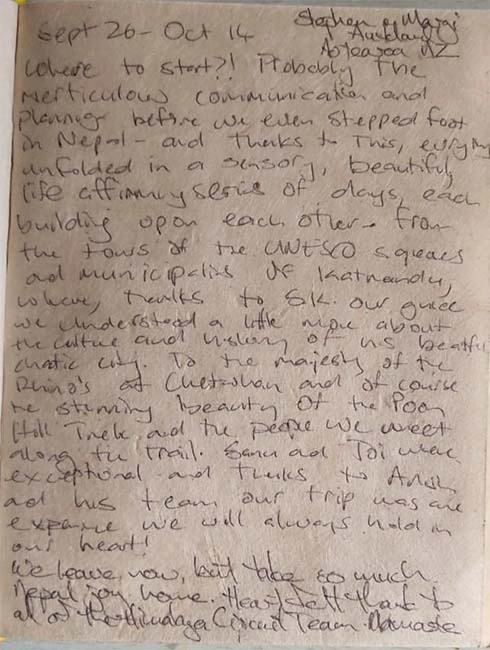
If you wish to inquire about Western and central Bhutan Tour prices and departure dates, please contact the Himalayan Circuit.
| 2 travellers | 4 travellers | 8 travellers | |
|
Standard
|
$ 2000 | $ 1800 | $ 1500 |
|
Deluxe
|
$ 2200 | $2000 | $1800 |


You will get the trip that you wish through our highly qualified and experienced tour planners customizing and creating the holidays as your preference.


A good balance of relaxation and adventure makes a happy trip.


You’ll want to keep going, keep exploring, keep living life to the fullest! Get Inspired
Our travel experts can help you decide on your personalized trip in Nepal
